
Govt okays 8 districts’ land use master plans: What to expect?
By Michel Nkurunziza.
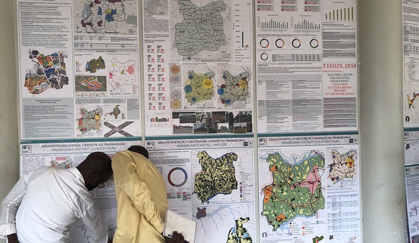
The cabinet meeting, held on May 22, approved land use and development master plans for eight districts.
The districts include Gakenke, Kirehe, Musanze, Ngoma, Nyaruguru, Rubavu, Rulindo and Rwamagana.
Of the 8 districts, Rubavu Musanze and Kirehe districts have secondary cities while Rwamagana has a satellite city.
ALSO READ: New land use masterplan is in line with Vision 2050
The secondary cities are far from Kigali while satellite cities are adjacent to Kigali city.
ALSO READ: Secondary cities need to harness their potential
Kirehe, whose the land use master plan was approved by cabinet on Wednesday , is one of the three new secondary cities (Karongi, Kayonza and Kirehe) to be developed in the second phase of the 2020-2050 National Land Use and Development Master Plan.
“We are a district with Rwanda-Tanzania border. That is why we have considered logistics hub of goods in our district where they can be collected and supplied to other parts across the country and beyond,” Vice Mayor of Kirehe District in Charge of Economic Development, Modeste Nzirabatinya, said.
He said the district with increased irrigation has taken into account an agro-processing hub.
Tourism development is also expected in the master plan implementation.
“One example is Nyarubuye hill, Akagera Valley and we have four lakes,” he said.
He added that since there is a boom in residential houses construction, the master plan has to ensure efficient use of land.
“We have other small towns such as Nyakarambi, Nasho and others,” he noted.
Richard Kagabo Rwamunono, the Rwamagana District vice Mayor in charge of Economic Development said that the district master plan emphasis was laid on “redefining and protecting agricultural land, currently at 51 per cent, but with a projection to increase it to 56.4 per cent by 2050.”
“Demarcation of urban and rural settlement sites to improve human settlement and accessibility to modern infrastructure, positioning Rwamagana as an Agribusiness and Logistics Hub, as well as leisure tourism was also emphasized on,” he said.
At least 16 mega projects are expected to play a significant role in the development of Rwamagana Satellite City during the implementation of the master plan up to 2050.
The land required for residential purposes in the new master plan in the city will increase from 665 hectares in 2020 to 1,750 hectares in 2035 and 2,205 hectares in 2050.
The development projects include upgrading Rwamagana district hospital, food market buildings, rehabilitating roads and setting up a transport hub to connect one of Rwamagana’s old markets dubbed (Uswahilini) to the Central Business District (CBD).
Uswahilini is a suburb in Rwamagana city mostly inhabited by Arabs that are descendants of traders from the Sultanate of Oman.
There is a new project to set up a planetarium in Rwamagana city.
Planetarium is a domed building in which images of stars, planets, and constellations are projected for public entertainment or education.
It is a theatre built primarily for presenting educational and entertaining shows about astronomy and the night sky.
The new master plan has also proposed upgrading genocide memorial site to be lined with the new city’s design.
The new master plan also seeks to set up a mega conference centre at provincial level that can host big national and international conferences.
A shopping mall where a duty-free army shop is located will be constructed.
The master plan again shows a youth innovation village/centre which will serve as ICT centre or a startup centre to support all innovative projects created in Rwamagana.
It has also envisioned a 7.7 hectare landfill that will be used to manage and dispose of waste generated in 2050 for urban areas estimated at 316 tonnes per day.
Under the new master plan, the industrial zone will be expanded.
Prosper Mulindwa, the Mayor of Rubavu District also told The New Times that an industrial zone will be developed to attract investors.
“The land use and development master plan also involves environment protection and disaster prevention. It show residential and non-residenial zones, zones for reforestation, rivers buffer zones, social activities, roads and other infrastructures,” he said mentioning the vulnerability to earthquakes, floods and landslides.
ALSO READ: Rubavu District revises master plan after volcanic earthquakes
He said agricultural land will occupy 47.3 per cent or 18,473 hectares up to 2050.
In this district, forest will cover 6,170 hectares, wetlands on 436 hectares, while residential zone is on 5,216 hectares.
Industries will occupy 229 hectares whereas eco-tourism and open space will be on 227 hectares.
Nyaruguru Holy land on 48 hectares
Janvier Gashema, Nyaruguru District vice Mayor in charge of Economic Development , said the master plan has a specialty in Kibeho town whereby a holy land of with 48 hectares was provided for religious tourism, sanctuary infrastructures like libraries, accommodations and church to be developed.
ALSO READ: What is the progress of 10,000-seater basilica project in Kibeho?
He noted that Kibeho commercial areas will have a visible change whereby only multi-storey buildings will be accepted given that this master plan mentions Kibeho as an urban area.
“The elaboration of this master plan was based on the principle of minimizing land to be occupied by buildings in order to increase agriculture land. The planned land for residential use occupy 5.1% while agriculture and forest land are planned to occupy 61.7%. The remaining 33.2% is planned for commercial; public facility; tourism areas; industry; wetland,” he said.
The master plan provides 124 residential sites, area for light industries.
“Hence we hope to receive investors to construct industries in our district.”
According to Auditor General Report for 2022/23 financial year , at least 14 districts had not developed land use plans meaning that the newly approved eight districts land use plans are additional to the City of Kigali and five districts that had approved land use master plans.
Districts without land use plans are Bugesera, Kayonza, Karongi, Rusizi, Kamonyi, Ruhango, Gatsibo, Nyamagabe, Rutsiro, Nyanza, Burera, Nyamasheke, Nyabihu and Ngororero
“Failure to have approved land use plans leads to increased land disputes between landowners and the districts. For example, the audit noted that there was encroachment on ecotourism, forest plantation zones and national park buffer zones,” auditor said.
Tags: Land use master plan, urban areas, secondary cities, satellite cities, indust



Leave a Reply